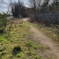
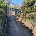
A map of the closed rail routes (marked in red) around Killamarsh and the Rother Valley Country Park. Drawn by myself onto an extract from Open Street Map.
Railway Routes: A to E: North Midland Railway (NMR), opened 1840, later Midland Railway; still open as the "Old Road" (Barrow Hill Lines) for regular freight and occasional passenger traffic. B to D: Manchester, Sheffield and Lincolnshire Railway (MS&LR), London extension, opened 1891; later formed part of the Great Central Railway (GCR) main line; closed to passengers 1966; remained open along this section to serve Arkwright colliery until 1983. C to F: the Langwith Junction to Beighton branch of the Lancashire, Derbyshire and East Coast Railway (LD&ECR), opened 1898; later part of the Great Central Railway; closed early 1980s when Westthorpe Colliery closed. b to G: Great Central "Waleswood Curve", opened 1893,closed 1967. a to H: Midland branch to Norwood and later to Kiveton Park collieries; opened 1869, closed at this end 1972.
Railway Stations etc.: 1: Killamarsh West (open to passengers 06/04/1841-02/01/1843 and 21/07/1873-01/02/1954); 2: Killamarsh Central (1892-1963); 3: Upperthorpe & Killamarsh (1898-1930); 4. Flour Mill.
Railway Junctions: a: Killamarsh Branch Junction. b: Killamarsh Junction. c: Killamarsh South Junction.
Chesterfield Canal (marked in blue) locations: z: Station Road bridge; y: LD&ECR overbridge.
- Posted on
- Monday 5 April 2021
- Keywords
- 1435 mm Gauge, Disused Railway, England, Infrastructure, Map, Station
- Visits
- 2943
- Rating score
- no rating
- Rate this photo

